Search This Blog

Tuesday, September 22, 2015

Yacaaba Head, Hawks Nest, NSW

As mentioned in previous blogs, we were so inspired by the views from Tomaree Mountain in Tomaree National Park that we vowed to return and go to the places we could see from the top. Looking north we saw the narrow neck of Wind Woppa Reserve leading to Yacaaba Head and it didn't take us long to discover that there is a walk from Hawks Nest to Yacaaba Head. Yacaaba Head is preserved as part of the Myall Lakes National Park.

Looking north from Tomaree Mountain to Yacaaba Head.
Before long we grabbed the chance to go to Hawks Nest. About 6.5 km off the Pacific Highway we stopped at Lion's Park. There are toilets and picnic tables and excellent views over Tea Gardens and out to Yacaaba Head and Tomaree Mountain. No camping is allowed here but there are several great options a little further on. Two popular caravan parks are North Coast Holiday Park Jimmys Beach (dogs allowed) and North Coast Holiday Park Hawks Nest Beach (no dogs). Myall River Camp (no dogs) is a little further north of Hawks Neck.

View from Lion's Park: Yacaaba Head (left) and Tomaree Mountain (right)
There are two starting points in Hawks Nest for the Yacaaba Head Walk, either from the carpark near the surf club at Bennets Beach or Jimmy's Beach Reserve opposite the North Coast Holiday Park Jimmy's Beach. We started from Jimmy's Beach Reserve which has toilets and picnic facilities. All up the walk is about 8 km return and is graded hard as fitness is required to climb Yacaaba Head to the top. We also found the sandy sections along Jimmy's Beach and Winda Woppa Reserve were a fair challenge on the calf muscles as the tide was in when we did the walk. Just north-east of Yacaaba Head lies Cabbage Tree Island where the John Gould Nature Reserve protects the only known breeding colony of the very rare Gould's Petrel. 

Walking along the beach to Yacaaba Head. Cabbage Tree Island on the left.
We crossed over Wind Woppa Reserve about halfway along and continued along the beach until we reached the base of the headland. There is a sign here indicating where the Yacaaba Head Walking Track is and giving a distance of 1 km to a viewpoint and 1.5 km to the summit.

The start of the track on Yacaaba Head.
The start of the walk is pleasant walking alongside smooth barked Angophora and gnarly old banksias. The track climbs steadily to the viewpoint with great views out over Winda Woppa, Jimmy's Beach and Tea Gardens.

The narrow neck of Winda Woppa Reserve with Jimmy's Beach in the background.
Of course we couldn't resist climbing to the top but be warned the last 500 meters is a steep scramble and the view is partly obstructed by shrubs and Grass Trees.

View of Fingal Island, Fingal Spit and Mount Tomaree (R), 
We didn't realise at the time of doing this walk that there is also a path around the base of Yacaaba to its pebbly southern side with views across the bay to Port Stephens. This area is called Dolphin Hole because dolphins frequent the area to rub their bodies on the smooth pebbles. So now we have a return visit added to our list for the future.


Tuesday, September 15, 2015

Tomaree National Park, NSW: revisit.

We previously posted a blog about Tomaree National Park and how that visit inspired us to return and have a closer look at the beautiful places we could see from Tomaree Mountain Lookout.


View from Tomaree Mountain Lookout: Zenith Beach, Stephens Peak, Wreck Beach, Quarry Hill and Box Beach.
A few months later we got the chance to return. On the way we stopped at Anna Bay to have a quick peek at the endless sand hills of Stockton Beach.


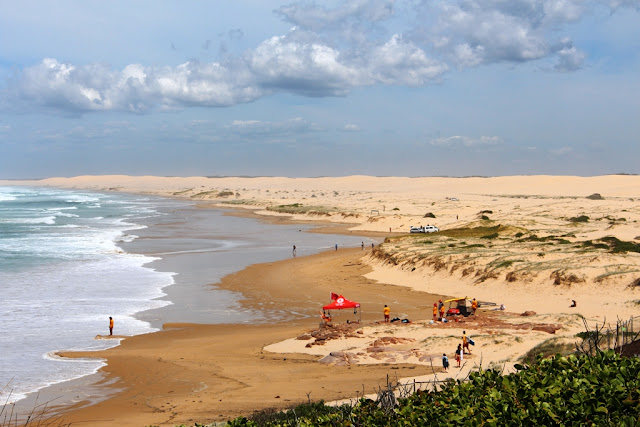
Stockton Beach
At Tomaree National Park we parked the car off Shoal Bay Road and walked the Tomaree Coastal Walk from Zenith Beach to Box Beach, a 4.4 km return walk, with a little extra distance for exploring the beaches.

Zenith Beach looking north to Tomaree Mountain.
Zenith Beach looking south to Stephens Peak.
The trail to Wreck Beach
Wreck Beach, looking north.
Box Beach, looking south.

We saw a couple of magnificent birds of prey riding the thermals at Wreck Beach and this Kookaburra along the walk.

Laughing Kookaburra
All and all a very satisfying day ticking off another wish list destination. 

Hmm, we will definitely have to return to explore Stockton Beach.

Tuesday, September 8, 2015

The Australian Army Flying Museum, Oakey, QLD.

We made a fast one day trip to Oakey last week. We were on a tight schedule but we've had the Australian Army Museum on our must do list for a while so we managed to fit in a visit while we were there. 
Australian Army Museum, Oakey.
Oakey is about 155 km west of Brisbane. Rotary Park on the bank of Oakey Creek is a nice place to stop for a break while in Oakey; it has picnic shelters, BBQ's and a playground. There is only one toilet in the park but it is quite an interesting one as it is fully automated and has tinkling music for added ambiance. We saw a pair of King Parrots near Oakey Creek and we would have liked to have had the time to stroll along the banks. No camping is allowed here but Jondaryan Woolshed is 18 km north west of Oakey and has paid camping. Bowenville Reserve is a popular free camping area a further 10 km on from Jondaryan.

Rotary Park, Oakey.
Oakey Creek.
The Australian Army Museum is on the outskirts of Oakey at the eastern end of Oakey Airport, on Museum Drive, off Corfe Road. Care should be taken not to enter the Army Base on Orr Road because you will have to turn around when you get to the guard house. There is a large car park at the museum and room to park a couple of RV's on the side near the fence. There is no cafe but there are several picnic tables outside the museum. We were impressed by the well appointed Oakey Civil Terminal, which can be found at the end of the car park and has toilets.

Oakey Civil Terminal
The museum is open Wednesday to Sunday 10 am - 3 pm. Entry is $7 per person or $15 per family. Our entry fee included a free high quality 96 page book, "The Australian Army a Brief History". There is a well stocked gift shop which sells cold drinks and the staff were friendly and helpful.We enjoyed wandering around looking at the planes. Don't miss the moving cutaway model of a Rolls Royce Merlin V12 and the side room containing memorabilia is also worth a look. There is a children's area with a box of army dress-up gear to keep the junior visitors entertained.

Dog Suit inside the memorabilia room.
 Below are some of the planes on display.

Pre World War 1, Box Kite, full scale replica.
Fokker Dr 1 Triplane, 
Pre World War 1, Deperdussin, full scale replica.
Bell 47 - Souix
Iroquois
Kiowa 206B-1
Boomerang CA-19
Outside the museum there are several mothballed Caribou aircraft and a GAF Nomad on the grounds of the army base that can be viewed through the fence. From the car park Army helicopters can be viewed coming and going from the base. 

We are really glad that we made the time to visit the Australian Army Flying Museum and would recommend a visit.

Tuesday, September 1, 2015

Angourie and Yuraygir National Park, NSW.

A couple of years ago we stayed in Yamba for a few days and while we were there we spent a day looking around Angourie and exploring the Angourie Walking Track which is part of the much longer, four day Yuraygir Coastal Walk.The entire Illuka, Yamba, Angourie area is so beautiful that it is high on our list for a return visit.


Green Pool
Blue Pool
To start the day, we parked in the car park at the end of The Crescent in Angourie and went to explore Green Pool and Blue Pool. These pools are the result of quarrying for rock to build the Clarence River breakwalls in the 1890's. A spring flowed into the excavations creating very deep fresh water pools adjacent to the ocean. The pools are popular for swimming and diving into from the high cliff faces. Sometimes swimming is not recommended due to algae blooms.


Walking south towards Angourie Point
From the pools we walked along the beach to the car park at the end of Pacific Street. The headland, Angourie Point, is a popular surfing break.


Walking south towards Angourie Point
Angourie Point
We walked south along the beach and across the base of Angourie Point to the next beach. The beach was covered in driftwood and large pumice stones. From the beach we walked up a beach access to the start of the Angourie Walking Track. This beautiful coastal track is a 10 km return, Medium graded walk.


The beach south of Angourie Point
The views from the track are absolutely stunning. I was so mesmerized by the view that I didn't notice a piece of wood that had been placed across the track, presumably as an anti-erosion device, and I fell very heavily flat on my face. I reached out my hand to save myself and dislocated a finger on some coffee rock at the edge of the track. 


Coastal heathlands on the Angourie Walking Track
We walked to Dirrangan Lookout and sat down for a picnic lunch with unsurpassed views of Yuraygir National Park. We had intended walking to Shelly Head Campground but with my finger swollen and painful we decided to head back to the car.


Shelly Beach with Shelly Headland in the background.
On the return walk we saw dolphins surfing the waves. From June to November, the walk is an excellent place to view whales on their annual migration.


Dolphin magic.
One of the highlights of the walk was watching a pair of Beach Stone-curlews patrolling the beach. They blended in well with the driftwood but were easier to see when they moved along the sand.


Beach Stone-curlews

We are definitely coming back to do this walk again and next time we also hope to camp at the Station Creek Campground to explore the southern end of Yuraygir National Park.