Search This Blog

Wednesday, February 25, 2015

Boreen Point, Qld.

Cootharaba Sailing Club, Boreen Point

Boreen Point is a pleasant village on the banks of Lake Cootharaba, 24 km north of Noosa. The lake is popular in the morning for kayaking and canoeing and with sailing and wind surfing in the afternoon, when the wind comes up. The water is shallow near the shore and is great for families with young children.


Lake Cootharaba

There are picnic tables overlooking the lake near the Cootharaba Sailing Club. There is a short walk in the Boreen Point Foreshore Reserve to a viewing platform over the lake and a plaque commemorating the rescue of Eliza Fraser who survived a shipwreck in 1836.

Boreen Point Foreshore Reserve Viewing Platform

Boreen Point Campground

Entry to Boreen Point Campground

Boreen Point Campground is a Noosa Council Holiday Park on the edge of Lake Cootharaba. There are eight powered sites suitable for small caravans, an open tent campground and bush camping sites for tents and camper trailers. There is no town water but there are hot showers and flushing toilets using bore water. Small dogs may be allowed but you need to download and submit an application before booking. Although it is worth noting that dogs don't seem to be allowed on the beaches at Boreen Point.There is an excellent new dump point and bins are provided. Kayaks can be hired from the campground office. One special feature of this campground is that boats and other watercraft can be left on the beach during your stay. There is also a walkway from the campground to the historic Apollonian Hotel.


Foreshore in the Boreen Point Campground

Open tent camping area

Bush campsites for tents and camper trailers


Thursday, February 19, 2015

Kinaba Information Centre and Mill Point Walks, Cooloola Section, Great Sandy National Park, Qld.

Dock at Kinaba Point on Lake Cootharaba

While camping at Elanda Point Campground we took the opportunity to do a couple of walks. The campground has it's own entry point to the walks which is great because the walks are shorter by about 600 m each way.  For more information on the campground please refer to our previous blog found here:

http://nationalparkodyssey.blogspot.com.au/2015/02/elanda-point-campground-great-sandy.html


Kinaba Information Centre Walk

The Kinaba walk is 11 km return from Elanda Point Campground or 12.2 km return from the National Park Carpark. This is an easy flat walk through a paperbark swamp so please wear appropriate clothes and take insect repellent. About 300 m into the walk there is a turn off to Mill Point but we walked on as we were going to do the Mill Point Walk the next day. 

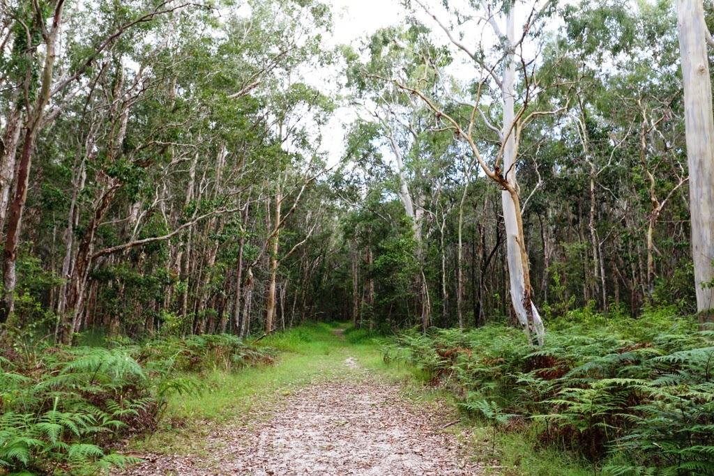
Kinaba Information Centre Trail

We saw a great variety of butterflies: Common Crow, Blue Triangle, Lemon Migrant, Meadow Argus, Blue Tiger, Caper White, Orchard Swallowtail, Swamp Darter and other Grass Darts. We only saw one Blue Triangle which made us think about how reduced their numbers seem to be these days where once they were very common. We thought we saw Richmond Birdwing butterfly vines but we didn't see the butterfly; another butterfly that has come under pressure although there has been substantial replanting of the vine in recent years.

Meadow Argus Junonia villida, wings closed

Meadow Argus Junonia villida wings open

Lemon Migrant Catopsilia pomona

Bar-shouldered Doves walked along the track ahead of us and Golden Whistlers sung alongside the track. We saw magnificent Brahminy Kites and White-bellied Sea-eagles. These large birds of prey were cautious of us and kept moving away which surprised us as we were walking in such an isolated area and we are used to the birds of prey in Pumicestone Passage taking no notice of mere humans below.

Brahminy Kite, sub adult

The walk took us through extensive Paperbark forest and pockets of Cabbage Tree Palms. We saw several goannas along the way. About 15 mins out from our destination we entered an area of Piccabeen Palms and it became damp underfoot. At this point we were inundated by mosquitoes and were very glad that we were wearing our light weight long sleeved "fishing" clothes. The remaining distance was covered at a fast pace. 

Lace Monitor (Goanna) Varanus varius in a Paperbark Tree Melaleuca quinquenervia

The Kinaba Information Centre is an impressive sight arising out of Lake Cootharaba. Thankfully, there was a stiff breeze blowing at Kinaba Point and the mosquitoes magically disappeared leaving us to enjoy a picnic lunch. We had the place completely to ourselves but a water taxi does call in here and it is a popular kayak and canoe destination. We didn't see any other people on the walk either. All manner of watercraft can be hired at Elanda Education Centre for reasonable prices.

Kinaba Information Centre

We took the time to explore around the Kinaba Information Centre which has information boards downstairs and toilets and a viewing area upstairs. We choose to sit in the breeze on the kayak launching platforms and soak in the tranquility. After our picnic we did the 300 m Mangrove Boardwalk Circuit and the Melaleuca Walk, 1 km return, before setting off back to Elanda Point Educational Centre Campground.


Boardwalk on Lake Cootharaba

Dock on Lake Cootharaba

Mangrove Circuit: Orange Mangroves Bruguiera gymnorhiza front of photo

Mill Point Walk:

The Mill Point walk is an easy, flat, 2.4 km return walk from Elanda Point Education Centre or a 5.1 km circuit from the National Park carpark.


Mill Point was once a thriving timber community and when you stand there today in the wilderness it is hard to visualize the vast size of the operation. There was a tragic accident here when a boiler exploded, injuring five workers, all of whom later died from their injuries.


We had heavy rain the night before we walked here and unfortunately the mosquitoes enveloped us in great clouds every time we stopped to look at anything so we weren't inclined to linger. This fungi was flourishing in the wet conditions though.


There are many more walks in the Cooloola Section of Great Sandy National Park and we only scratched the surface in our short time there.

Trailhead from Elanda Point Campground

Monday, February 16, 2015

Elanda Point Campground, Great Sandy National Park, Qld.


Sunrise at Lake Cootharaba

Elanda Point Education Centre & Adventure Park is a privately run campground, education centre and canoe hire centre on the banks of Lake Cootharaba on the edge of the Cooloola Section of the Great Sandy National Park. It is only a 25 km drive north of Noosa and is accessible by 2WD. However, the long driveway requires some care as it has a number of large potholes. There are mixed reviews online about camping there; largely because they have a number of signposted rules and because they do not take dogs. However, those that don't object to the rules usually state it is one of their favourite campgrounds; a very pleasant, family friendly lakeside location with a great variety of activities.


Colourful Cabins at Elanda Point Education Centre

Elanda Point Campground adjoining Lake Cootharaba

The campground itself is large and has plenty of open grassy space with some trees for shade and shelter from the wind that comes in off the lake in the afternoons. There is room for caravans, motorhomes, camper trailers and tents. There are no powered sites. There are toilets and hot showers near the entry kiosk and two other toilet blocks with cold showers in the grounds. There are also some outdoor showers with taps throughout the grounds. There are industrial bins for rubbish near the entrance. No pets are allowed and no fires are allowed on the ground. While we were there, a group of school children camped in tents near the entry and the place is so big that you barely noticed they were there. There is also a separate area with colourful cabins for groups. On top of all this they are a hire centre for kayaks, canoes and small boats. People were enjoying the shallow shore waters of Lake Cootharaba even late in the afternoon.


Families enjoying the lake late in the afternoon

As the weather had been very windy we decided to put our tent up further away from the lake, behind some trees. It was very peaceful and our campsite was visited by Kookaburras and a very large goanna. The dominant birds in the campground were Noisy Miners but we did see King Parrots fly in at dawn and dusk. We also had a visit from a couple of Pacific Black Ducks who promptly went to sleep next to our tent. There were kangaroos lazing around the outer fields and I spotted a pair of Bush Stone-curlews between the entrance and the cabins.


Our tent at Elanda Point Campground

Pacific Black Duck settling in for a restful sleep

We came to do a couple of walks in the Great Sandy National Park. Camping at Elanda Point Campground worked out well for us, as there is direct access from the campground to the walks and it is about 1.2 km return shorter than walking from the National Park Carpark in Lake Flat Road. We will cover the walks to Mill Point and Kinaba in the next blog. We enjoyed our stay at Elanda Point and we thought it was good value at $24 dollars a night for two people because you can arrive anytime after 8.00 am and leave anytime between 8.00 am and 6.00 pm the next day. Take $10 cash for a refundable key fee. We look forward to returning and perhaps hiring kayaks for the day. 

All photos were taken in February 2015.


Thursday, January 29, 2015

Mooloolah River Floodpain, Sunshine Coast, QLD.


Mooloolah River

While looking on Goggle Earth recently, we discovered that there was an interesting looking trail from near the Kawana Soccerfields to the banks of the Mooloolah River. We parked our car at the western end of Main Drive in Warana, near an information board about the Mooloolah River Floodplain walk. To our surprise, we discovered an elevated concrete walkway which goes for 2 km through wetland to the Mooloolah River. 


Elevated Concrete Walkway

There was a variety of butterflies, lizards and dragonflies alongside the walkway.


Wall Skink Cryptoblepharus virgatus


By walking as quietly as we could we were able to observe a large number of small crabs in the floodplain below the walkway. The only ones we know are the Red-fingered Marsh Crabs. Their name always amuses us because it completely ignores the fact that these crabs a such a lovely green. We were particularly taken by the appearance of the two-tone black and white crabs. 


Red-fingered Marsh Crab Parasesarma erythodactyla
Semaphore Crab Heloecius cordiformis


After arriving at the banks of the Mooloolah River, we continued on a rough trail for a short distance through a grassy area. There were a number of milkweed plants in the grass and quite a few Monarch butterflies. This trail appears to continue for some distance but as the afternoon light was fading we turned back.

Near the bank of the river, we observed a pair of Whistlers. The adult male Whistler looked different to any Golden Whistler that we have ever seen because the throat area wasn't white; it was more of a speckled grey, and the neck and chest area was a deep orange-yellow. The other whistler had more green and russet colouring than we have observed before. Unfortunately, the light wasn't ideal for photography by this time but we hope the photos show what we mean. Perhaps they were Mangrove Whistlers? 


We would be very pleased if our readers could let us know what these crabs and any of the unlabelled photos are. Any thoughts on the Whistlers would also be appreciated. 

Note added in March 2015: We have since discovered that Mangrove Whistlers don't come this far south so these photos are of Golden Whistlers. Greg Roberts who, amongst other things, writes the excellent blog at http://sunshinecoastbirds.blogspot.com.au/
has let me know that he has also seen Golden Whistlers that look like these on the Sunshine Coast.

Friday, January 23, 2015

Springbrook National Park QLD, Part 4: Best of All Lookout, Wunburra Lookout and Apple Tree Park.

Here are a few other places that are worth taking a look at while visiting Springbrook National Park.

Best of All Lookout

While visiting the Twin Falls area of Springbrook National Park it is worth a short detour to the Best of All Lookout on the Queensland-New South Whales border. Drive slowly along the access road as there are large numbers of pademelons about. The track is a Class 2, 600 m return walk which passes through remnant Antarctic Beech Forest on the way to the lookout.


Arctic Beech Nothofagus moorei

From the lookout there are extensive views of the Gold Coast hinterland over the eroded northern rim of the extinct Tweed shield volcano and out to the ocean. Mount Warning and the twin peaks of Mount Cougal dominate the landscape.


Mount Warning

Mount Cougal

Wunburra Lookout

Wunburra Lookout is a few kilometers north of Springbrook and has views over Little Nerang Dam and across Purling Brook Gorge to the Gold Coast.

Little Nerang Dam
View to the Gold Coast from Wunburra Lookout


Apple Tree Park

Apple Tree Park is a lovely shaded park with good parking, BBQ's, picnic tables and toilets. It is an entry point for the Gold Coast Hinterland Great Walk; a serious 54 km walk which requires booking in advance and a topographic map of the area. If you are tempted to have a quick look at the Great Walk be aware that the track that heads west from the park descends steeply over about 250 m; which means returning to the carpark via approximately 900 steps! You might prefer to cross the road and walk partway along the section of the walk that heads south-east to Warringa. In this section of the walk we saw this old tree stump where you can still clearly see the holes where planks were inserted to support the forester as the tree was cut down. 


Tuesday, January 20, 2015

Natural Bridge, Springbrook National Park, QLD.

Natural Bridge

The Natural Bridge section of Springbrook National Park is 28 km from Settlement Campground in Springbrook via a very scenic drive through the Numinbah Valley. If you are looking for somewhere closer to stay, The Log Cabin Camp is a privately owned campground very close to Natural Bridge. We have not been there but we believe the fees are $10 per person per night. 

We arrived at the Natural Bridge carpark at 7.00 in the morning and there were no other people around. We saw several Logrunners, both male and female, Brown Cuckoo-Doves, and pademelons enjoying the quite before the arrival of more tourists. In the evening it can get busy here because people come to view glow worms in the cave beneath Natural Bridge. From the carpark, there is a pleasant 1 km circuit walk that meanders down to Natural Bridge and back around the top where the water flows into the rock cavity. In years gone by it was possible to walk along the creek and swim but now these activities are prohibited.


Natural Bridge, from below.

 Natural Bridge, from above.

There were eels in the water and we saw the biggest worm that we have ever seen on the path.


Eel

On our drive back through the Numinbah Valley we stopped several times to enjoy this beautiful area. Opposite The Natural Arch Cafe there is a surprising vista of dinosaurs in the hills. If you are interested in bridges you might like to stop and peer under the bridge over Cave Creek. The size of the timber used to construct the bridge is amazing.


Dinosaurs roaming around the Numinbah Valley.
Cave Creek

If you don't have time to fully explore Springbrook National Park it is still well worth a drive from the Gold Coast to see Natural Arch.