Search This Blog

Thursday, November 27, 2014

Lake Tarawera Outlet and Tarawera Falls, North Island, New Zealand

In January we went to Lake Tarawera Outlet in New Zealand. This beautiful area has a large DOC (Department of Conservation) campground and is the starting point for the Tarawera Outlet to (Tarawera) Falls Track.
Lake Tarawera Outlet, looking west over LakeTarawera

Lake Tarawera Outlet, looking north. 
The Lake Tarawera Outlet Campsite has 50 tent sites, tap water, toilets, a cooking shelter, picnic tables and a boat ramp. Dogs are permitted on leash. It is $6 per adult and $3 for 5 to 17 year olds, per night. No bookings are taken. There is also a permit required to access the forestry road to the campsite which costs $5. Tickets are purchased at Kawerau Information Centre, Plunket Street, Kawerau. Kawerau is about 55 km east of Rotorua and the drive is very scenic. 


Lake Rotoma, between Rotorua and Kawerau.

Be sure to get directions and a map to Lake Tarawera Outlet Campsite from the Kawerau Information Centre because Goggle Maps lists the campground as only 1.6 km away which is not the case. The campground is on the eastern shore of Lake Tarawera, approximately 25 km from Kawerau by good gravel roads. The forestry gate is closed at night and during times of high fire danger.


Kawerau, looking at Mount Edgecumbe.
Forestry Road to Lake Tarawera Outlet (looking back towards Mt Edgecumbe).
A footbridge links the campground to the Tarawera Outlet to (Tarawera) Falls Track. The track is 3.5 km one way with an estimated time of 2 hours. Turn right after the bridge. This section of Tarawera River is a designated Trout Spawning Sanctuary.


Looking west from the bridge over Tarawera River to Lake Tarawera.

Footbridge over Tarawera River, looking back at the Campground and Mount Tarawera.

Looking east from the bridge over Tarawera River.

The walking track mostly follows the river which is unbelievably clear and beautiful. 

Tarawera River
A short section of the track is over a dry volcanic plain.


Dry volcanic section of the track.

Then the track returns to follow Tarawera River.


Tarawera River

The Cascades, Tarawera River.
We didn't have a birding camera with us but we did manage to get a photo of a gorgeous Tomtit; a bird we don't have in Australia.


Tomtit
We turned around where the track descends steeply down to the waterfall and returned to the campground. Later in the day we drove to the Tarawera Falls carpark and walked the short distance to the base of the falls where there is a viewing area and seats. 


The walk to Tarawera Falls from the carpark.

Tarawera Falls is the most stunning waterfall we have ever seen. This photo simply does not do it justice. The water gushes out of the rock face in several places and the noise is incredible.


Tarawera Falls

In all out travels, the Tarawera area would have to rate as one of the most beautiful places we have ever seen.

Monday, November 24, 2014

Noosa National Park, QLD

On this visit to Noosa National Park we parked at the carpark in Seaview Terrace, Sunshine Beach. We took Beach Access 27 to Sunshine Beach and walked north along the beach to the entry to the national park. We have at other times parked in McAnaly Drive, which has limited street parking, and walked northeast into the national park. Walking into Noosa National Park this way avoids the crowds that walk the Coastal Track from the information center at the end of Park Road in Noosa Heads. 

Walking track map:
http://www.nprsr.qld.gov.au/parks/noosa/pdf/noosa-headland-map.pdf

Walking up into the national park from the beach there is a long steep stairway but the views are worth it.

Looking south along Sunshine Beach from the top of the stairs.

Headland Section from Sunshine Beach to Devils Kitchen and Lion Rock.


Devils Kitchen

Lion Rock

Black Jezebel Delias nigrina

Little Shrike-Thrush

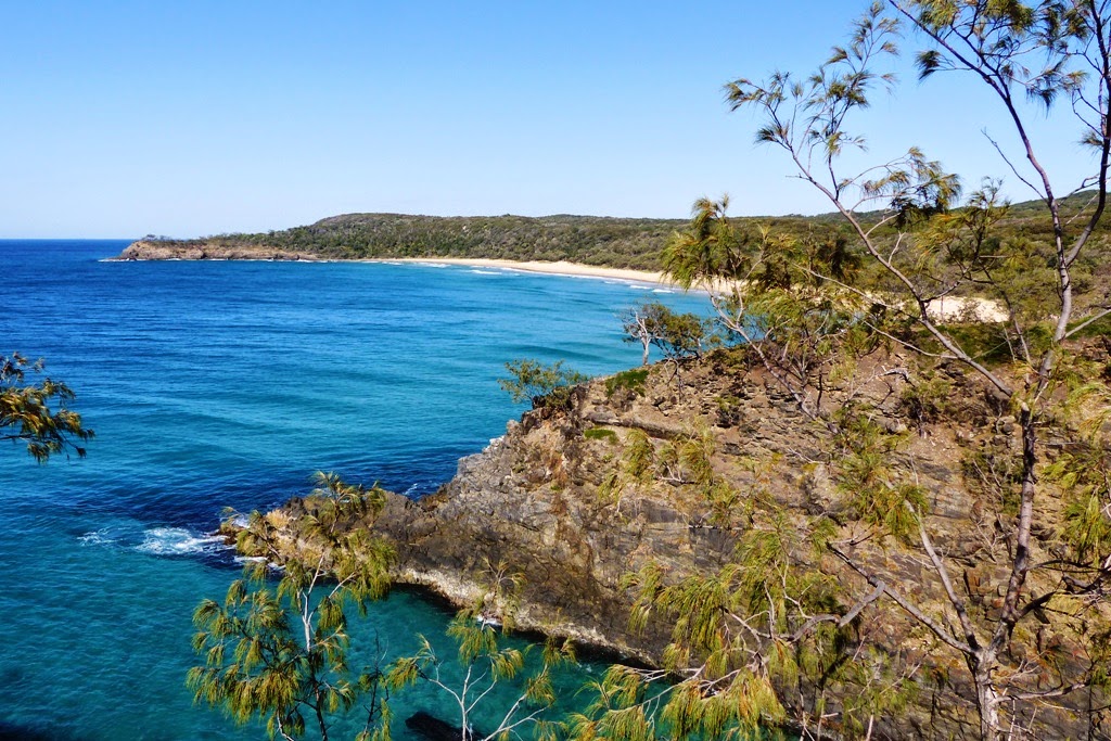
Alexandria Bay

We timed the walk nicely to be at Alexandria Bay at low tide for easier walking.
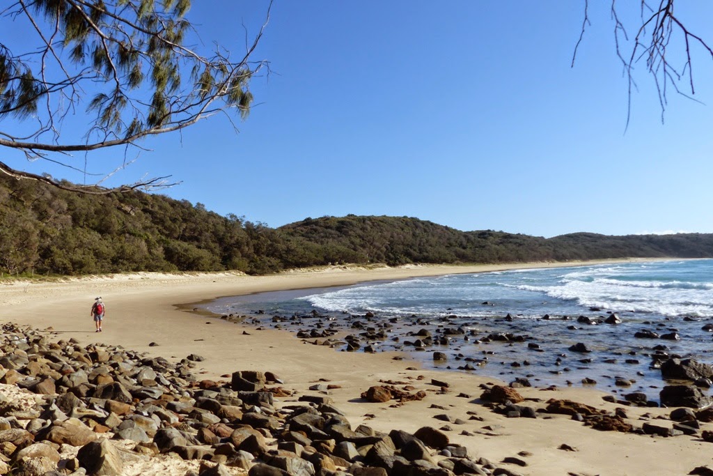
Walking north along Alexandria Bay

There are three things you should know about Alexandria Bay: 
It is very isolated and beautiful. 
It is extremely dangerous to swim here because of treacherous rips and many people have drowned here. 
It is a nudist beach.

As we were walking along the beach, I was busy trying to focus on a distant bird in the tree line and I didn't realise until I lowered my camera that there was a nudist doing elaborate poses for my benefit because he thought I was photographing him. LOL.
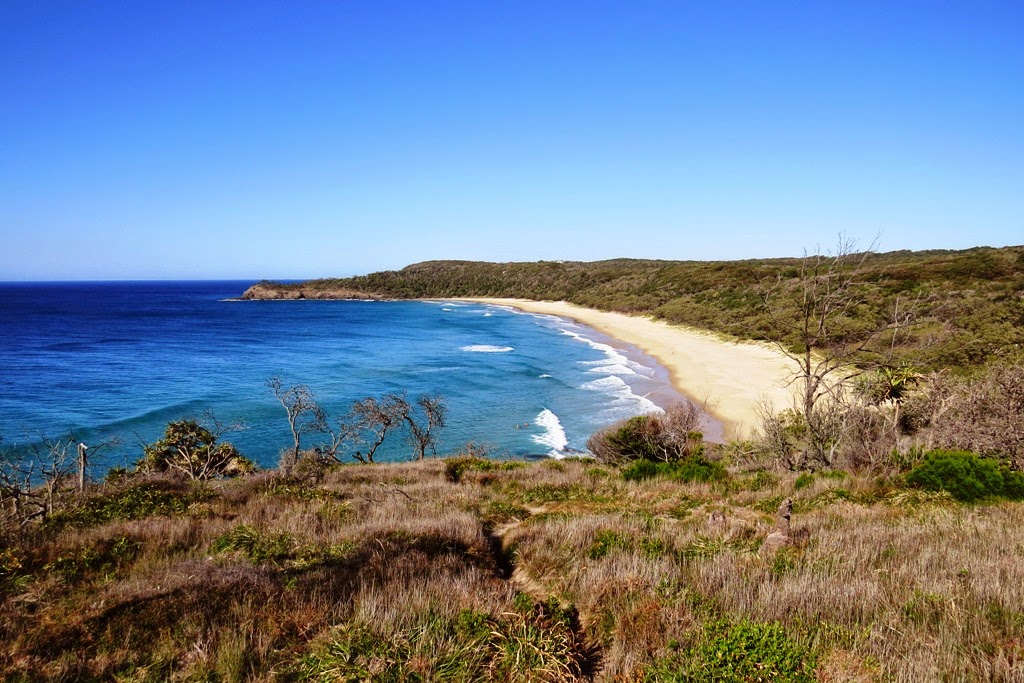

Looking back (south) over Alexandria Bay

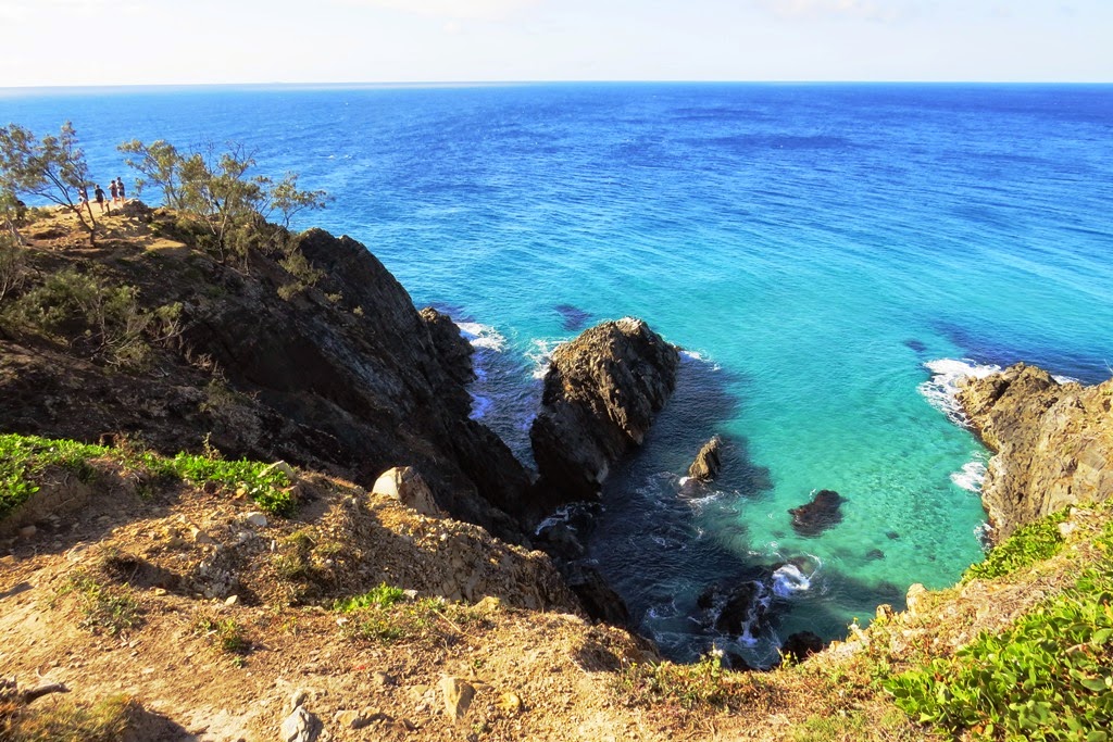
Hells Gate


Hells Gate, Noosa National Park

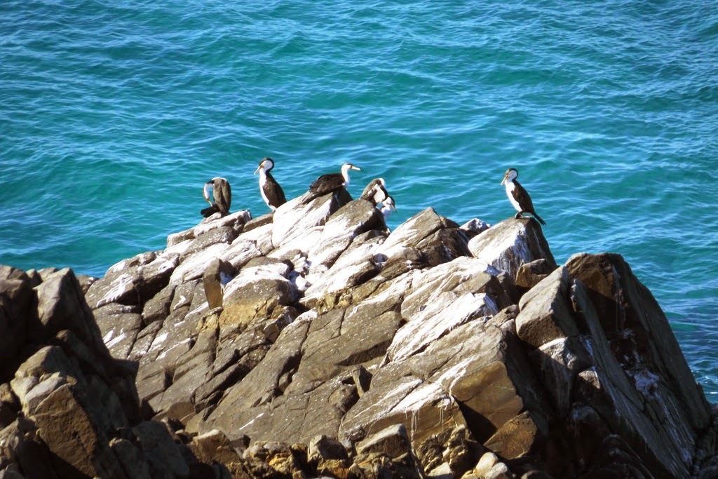
Pied Cormorants at Hells Gate.

Major Skink Habitat

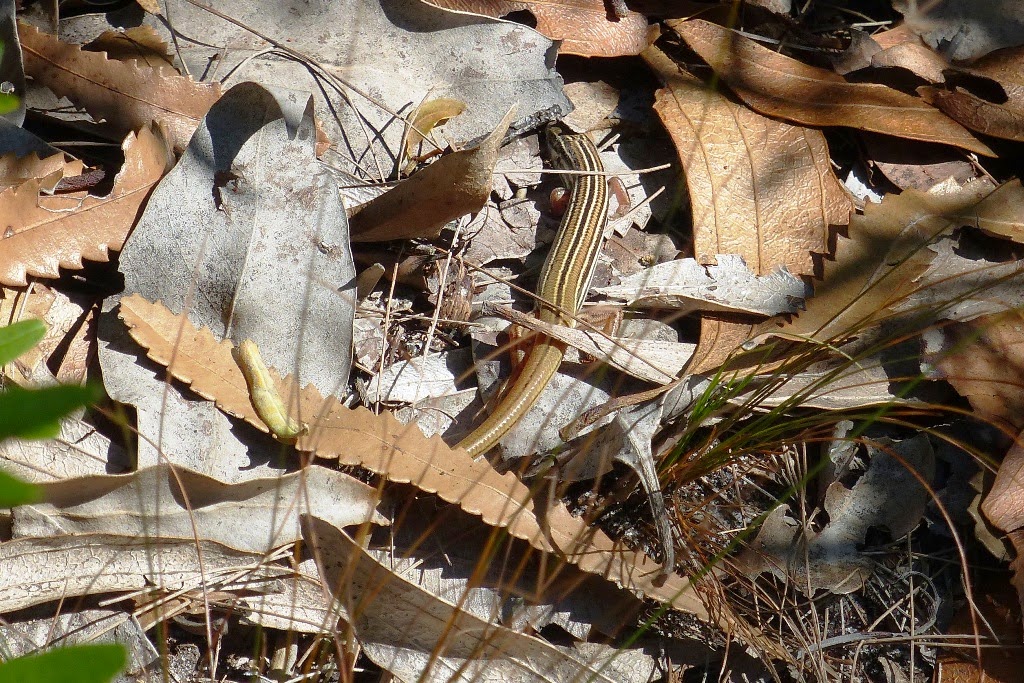
I walked down the right side (when facing the ocean) of Hells Gate, there is a bit of a track to follow along the ridge line but care should be exercised. I have seen Major Skinks Egernia frerei there previously but there were none to be seen on this trip. They look like golden Land Mullets Egernia major and I was hoping to get a photo this time.

Picnic Cove

We walked around the headland with views over Granite Bay and on past Picnic Cove then we turned south on the short link to Tanglewood Track. 
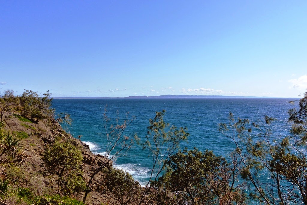


Views over Granite Bay


Tanglewood Track

This track is more isolated than the other walks. It is a shady walk through rainforest and woodlands. Here orchids and epiphyts can be seen in the trees. The highlight of the morning was a magnificent Noisy Pitta just standing out in the open on some leafy mulch but it ran away when it saw us stop. Then we took the link to Alexandria Bay Track before taking the link track south to McAnaly Drive. 


Bar-shouldered Dove

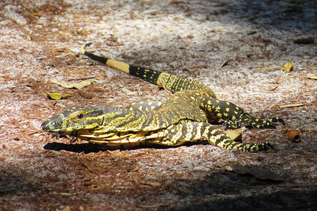
Lace Monitor Varanus varius

Copper-tailed Skink Ctenotus taeniolatus

 We walked down McAnaly Drive and returned to the car park. 

We walked past this interesting house. 

If following this route, allow up to half a day, take plenty of water, a snack and a map as some of the links are fairly confusing. The walk varies from a Class 2 to a Class 4.

We also highly recommend the Coastal Track walk that starts at the main entrance to the National Park, at the end of Park Road Noosa Heads. The walk is a Noosa classic with stunning views and a Noosa surfing vibe.


Saturday, November 22, 2014

Currimundi Lake (Kathleen McArthur) Conservation Park, QLD: Wildflowers and Butterflies.

Late winter through to spring is an especially good time to see wallum wildflowers at Currimundi Lake (Kathleen McArthur) Conservation Park. 


Currimundi Lake Conservation Park in September 2014

Where there are flowers there are butterflies:


Common Crow Euploea core
Varied Eggfly Hypolimnas bolina

Scarlet Jezebel Delias argenthona


Gum Tree Shield Bug Theseus modestus


Wildflowers and Plants:

Some of these we (think) we know the names of. Please feel free to let us know the names of any of these plants if we have it wrong or have not labeled the photo.

Hop Bush Dodonea triquetra

Sweet Wattle Acacia sauveolens

 Flax Lily Dianella caerulea

Fan Flower Scaevola calendulacea

Twinning Guinea Flower (Snake Vine) Hibbertia scandens

Angular Pig Face (Coastal Pigface) Carpobrotus glaucescens

Coastal Banksia Banksia integrifolia

Coastal Wattle Acacia sophorae

Weeping Baeckea Baekea frutescens

Wedding Bush Ricinocarpos pinifolius

Cats Ear Hypochaeris radicata ( environmental weed)


We would really love to know the name of this plant.


As a reward for all the fauna lovers out there for getting through all this flora, above is a photo of a very light grey Bearded Dragon Pogona barbata that was out in the open. 

For walks, birdlife and further information about Currimundi Lake (Kathleen McArthur) Conservation Park please refer to our previous blog:

http://nationalparkodyssey.blogspot.com.au/2014/11/currimundi-lake-kathleen-mcarthur.html